-
by
Sam Barron
Breaking News
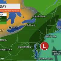
It was a rainy Sunday, July 9, in Northern New Jersey.A heavy storm brought massive rainfall to the area. According to the Rutgers NJ Weather Network:Charlotteburg in West Milford 3.07 inches of precipitation.Haworth got .38 inches of precipitation.Jersey City got .18 inches of precipitation.Little Falls got .31 inches of precipitation.Lyndhurst got .25 inches of precipitation.North ...
-

by
Joe Lombardi
Weather
New separate rounds of thunderstorms will mark a damp and dreary weekend amid a rainy, unsettled stretch of weather that will linger into next week.Showers and scattered storms with moderate to heavy downpours that arrived overnight will taper off from south to north late Saturday morning, June 24 with a warm front passing, according to the National Weather Service.A new round of storms ...
-

by
Joe Lombardi
Weather
The arrival of an unsettled weather pattern will bring the possibility of thunderstorms stretching into early next week.It will be warmer and more humid Friday, June 23 with a high temperature ranging from the mid to upper 70s, and showers likely at times throughout the day and evening.Scattered thunderstorms will arrive mid-afternoon, lasting through the evening, as a warm front passes ...
-

by
Joe Lombardi
Weather
The start of summer will be followed by a change in the weather pattern that will last through the weekend.The summer solstice occurs at 10:57 a.m. Wednesday, June 21, marking the official start of the season.High pressure will bring largely dry and seasonable weather to the region, according to the National Weather Service. High temperatures Wednesday will range from the low 70s along ...
-

by
Joe Lombardi
Weather
A line of thunderstorms, some severe, is sweeping through the region from west to east.Storm activity first began in northern New Jersey at around 1:30 p.m. Friday, June 16. As of around 2:30 p.m., most of the more powerful storms have been in areas farthest south, with showers falling throughout much of the entire region. (See the satellite image above.)Storms are expected to become ...
-
by
Joe Lombardi
Weather
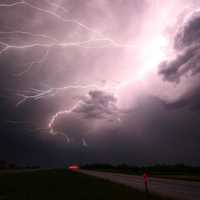
Father's Day Weekend won't be a complete washout, but it will be marked by the return of an unsettled weather pattern.After a wet and stormy day, Thursday, June 15 will be the pick of the week, with mostly sunny skies and a high temperature ranging from the upper 70s to lower 80s.But the pleasant weather won't last long.Friday, June 16 will be mainly cloudy with showers likely to arrive ...
-

by
Joe Lombardi
Weather
A second, stronger storm system of the weekend will bring scattered thunderstorms and gusty winds to the region.Sunday morning, April 30 started off with scattered rain showers and areas of dense fog following a wet, windy day on Saturday, April 29 which brought a widespread 1 to 2 inches of rainfall, the National Weather Service said.The next storm system will arrive from west to east ...
-

by
Joe Lombardi
Weather
A potent cold front will bring scattered, strong thunderstorms with heavy rain, and gusty winds to the region overnight.Mostly cloudy skies and patchy fog on Saturday morning, April 22 will give way to breaks of sunshine during the afternoon, according to the National Weather Service. Temperatures will be mild, topping out in the mid-60s.Widespread showers and isolated thunderstorms ...
-

by
Joe Lombardi
Weather
An unsettled weather pattern that has arrived in the region will include scattered thunderstorms and dramatic shifts in temperatures.Morning fog on Thursday, April 6 will give way to partial sunshine with a line of showers and isolated thunderstorms moving in for the afternoon and evening, according to the National Weather Service. Parts of our area have been upgraded to a slight risk ...
-

by
Joe Lombardi
Weather
The month of April will get off to a stormy start with steady rainfall at times followed by severe thunderstorms with damaging winds that could cause power outages.The system arrived in the pre-dawn hours on Saturday, April 1 with rain and showers.Storm activity is expected to pick up in the afternoon through the evening. For a look at the wide area where severe storms are possible, see ...
-

by
Joe Lombardi
Weather
Damaging wind gusts that could cause power outages will be the main threat from a potent storm system that will sweep through the region.It's on track to arrive overnight Friday, March 31 into Saturday, April 1, with scattered thunderstorms at times through early Saturday evening before the system moves out, according to the National Weather Service. Wind gusts during the height of the ...
-

by
Ben Crnic
Weather
Although most of the winter was snow-free for the most part, residents across Connecticut saw plenty of the white stuff fall thanks to a late-winter Nor'easter. Related Story - Nor'easter: Potent Storm With Gusty Winds Brings Mix Of Snow, Rain, Causes School ClosuresThe storm, which began on Monday evening, March 13, and continued into Tuesday, March 14, brought several inches of rain ...


